2026
Research Grant Awardee
Virginia Space Grant Consortium (VSGC) / NASA
Competitive research funding supporting satellite-based precipitation retrieval and soil moisture science.
Ph.D. Candidate · Johns Hopkins University
Computational hydrologist — physics-informed AI for observing the global water cycle from space.
I'm a Ph.D. candidate in Geography & Environmental Engineering at Johns Hopkins, advised by Venkataraman Lakshmi. I build physics-informed AI systems that estimate precipitation and soil moisture from space — fusing what the land remembers of past rain with what radiometers, radar, and reflectometry measure directly, across SMAP, GPM, CYGNSS, and NISAR. Hydrological physics stays inside the learned model so the answer remains interpretable, and every estimate reports how much to trust it rather than a single number.

Recognition
Competitive research funding and recognition for peer-review contributions to the field.
Virginia Space Grant Consortium (VSGC) / NASA
Competitive research funding supporting satellite-based precipitation retrieval and soil moisture science.
Vadose Zone Journal
Selected for exceptional peer-review contributions, one of eleven journals served as reviewer.
Current work
Five active threads, from manuscripts in preparation to mission-era proposals — physical rigor first, learning second.
A physics-informed temporal neural operator coupled with adaptive flow matching. Rainfall is reconstructed from several complementary satellite signals through a mixture of experts — one reading the land's fading memory of rain, one the microwave brightness the surface emits, one the atmosphere's water budget — each weighted by how observable its signal is for a given event, so every estimate carries its own uncertainty rather than a single number.
A selective prediction framework for CYGNSS land retrievals, asking which observations can be trusted at a user-chosen risk tolerance. Method and results to be presented at the AGU Annual Meeting 2026.
Testing whether a modern transformer-based land surface emissivity model improves GPM precipitation retrieval in the regimes where it fails most — arid, tropical, and complex terrain — and quantifying the resulting error reduction at the IMERG level.
NISAR images the land surface at field scale, but days pass between overpasses — too infrequent for irrigation scheduling, recharge assessment, or tracking a rapid dry-down. This work targets that temporal gap: turning intermittent acquisitions into a continuous daily record of surface and root-zone moisture, recharge opportunity, and irrigation deficit risk, with vadose-zone physics kept inside the model.
Reformulates SM2RAIN from a fixed pixelwise inversion into an end-to-end differentiable, memory-aware retrieval: a neural parameter network learns bounded, state-dependent coefficients and multi-day wetting weights that feed a soil-water-balance decoder, rather than predicting rainfall directly. Evaluated across CONUS against GPM IMERG and, independently, against GHCN-Daily gauges — testing whether soil-moisture memory can serve as a complementary pathway if GPM observations are interrupted.
Latest
Convening · 7–11 December 2026 · San Francisco
Hydrology is entering a paradigm where satellite remote sensing, physics-based modeling, and AI foundation models converge. This session unites the hydrology, remote sensing, and AI communities around frameworks that link observation and state space and enable end-to-end water cycle prediction across scales.
 Hyunglok KimGISTAssistant Professor
 Kristen WhitneyNASA GSFCGoddard Space Flight Center
 Ehsan JalilvandNASA GSFCGoddard Space Flight Center
 Le Manh-HungNASA GSFCGoddard Space Flight Center
 Venkataraman Lakshmi
 B. Howell Griswold, Jr. Professor, Johns Hopkins University
 Mohammad SaeediPh.D. Candidate, Johns Hopkins University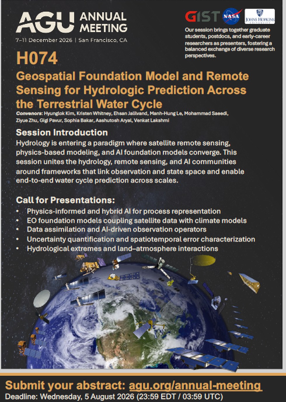
Session flyer · see the announcement on LinkedIn →
I welcome collaboration on physics-informed retrieval algorithms, satellite soil moisture validation, and precipitation reconstruction — and I am always glad to review for journals in the field.
About · Doctoral research
Supporting GPM through NASA multi-mission observations — my dissertation at Johns Hopkins, advised by Venkataraman Lakshmi.
Satellite soil moisture holds an indirect record of the rainfall that produced it — but reading rainfall back out of that record is an ill-posed inverse problem. Soil moisture also responds to drainage, evapotranspiration, runoff, retrieval noise, and delayed land-surface response, and intense storms can leave a weak or even negative same-day signal.
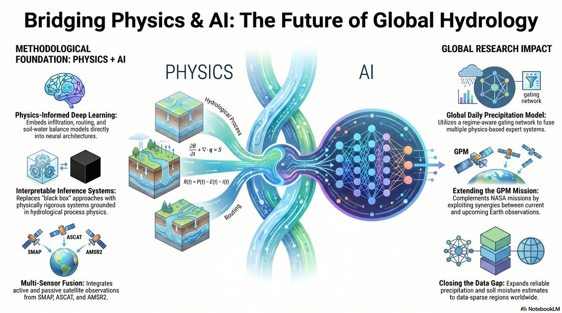
My work makes that inversion tractable by constraining it with physics rather than replacing physics with a black box. Hydrological formulations — Green-Ampt infiltration, Muskingum-Cunge routing, analytical net water flux — stay intact inside learned architectures, while neural operators, graph attention networks, and geospatial foundation models supply the parameterization those formulations need in places where no gauge exists.
Increasingly the question is not just how much rain but how much to trust the answer — so recent work produces calibrated distributions rather than single numbers, and uses conformal risk control to retain only the retrievals that meet a stated error tolerance.
Interests
Physics-informed learning and geospatial foundation models sit at the centre; everything else follows from applying them to real Earth observations.
Hydrological formulations embedded as constrained, interpretable components — with Fourier-domain operator learning, learned advection, and source–sink corrections for land-surface memory.
Frozen encoders such as Prithvi-EO-2.0 over HLS imagery to represent persistent land-surface conditions, and foundation-model-driven validation frameworks for Earth observation.
Probabilistic and ensemble retrieval through conditional flow matching, plus conformal risk control and selective prediction to bound error at a user-chosen tolerance.
SMAP, ASCAT, AMSR2, CYGNSS delay–Doppler maps, and emerging NISAR and OPERA products for soil moisture and land surface state.
Recovering rainfall from soil moisture, streamflow, and learned subsurface boundary conditions, with regionalization that transfers to ungauged basins.
Drought–flood transitions, heavy-event recall, and precipitation reconstruction across data-scarce regions worldwide.
Projects
Current work carried out as a Graduate Research Assistant at Johns Hopkins and the University of Virginia, plus earlier algorithm development and fieldwork.

A physics-informed learning framework that replaces fixed process-model parameters with learned, interpretable ones — keeping the hydrological process model intact while letting data determine how it is parameterized.
A selective prediction framework that reads CYGNSS delay–Doppler maps, observation geometry, and land-surface characteristics to identify which soil moisture retrievals are reliable, using conformal risk control to retain observations under a user-defined error tolerance.

A self-calibration framework that eliminates long calibration periods by regionalizing model parameters with unsupervised learning — K-means, Gaussian mixture models, agglomerative clustering, and Growing Neural Gas. Hold-out and leave-one-out protocols demonstrate improved transferability to ungauged regions.
Physically based infiltration modeling integrated into SM2RAIN for robustness under heterogeneous soil and antecedent-moisture conditions, with systematic sensitivity analysis and Monte Carlo uncertainty quantification across climate, soil, and land-cover regimes.
An inverse hydrologic framework that recovers effective rainfall from outlet discharge by coupling Muskingum–Cunge routing with Green–Ampt infiltration, with emphasis on river-network dynamics, runoff-generation processes, and data-scarce basins.
A global daily precipitation model that fuses multiple physics-based experts through a regime-aware, reliability-weighted gating network, with gauge-only magnitude supervision, multi-timescale sequence encoding, and domain adaptation for physically interpretable prediction in data-sparse and ungauged regions.
Foundations
Algorithm development and field measurement from the M.Sc. period that the current research builds on.
2020 — 2022
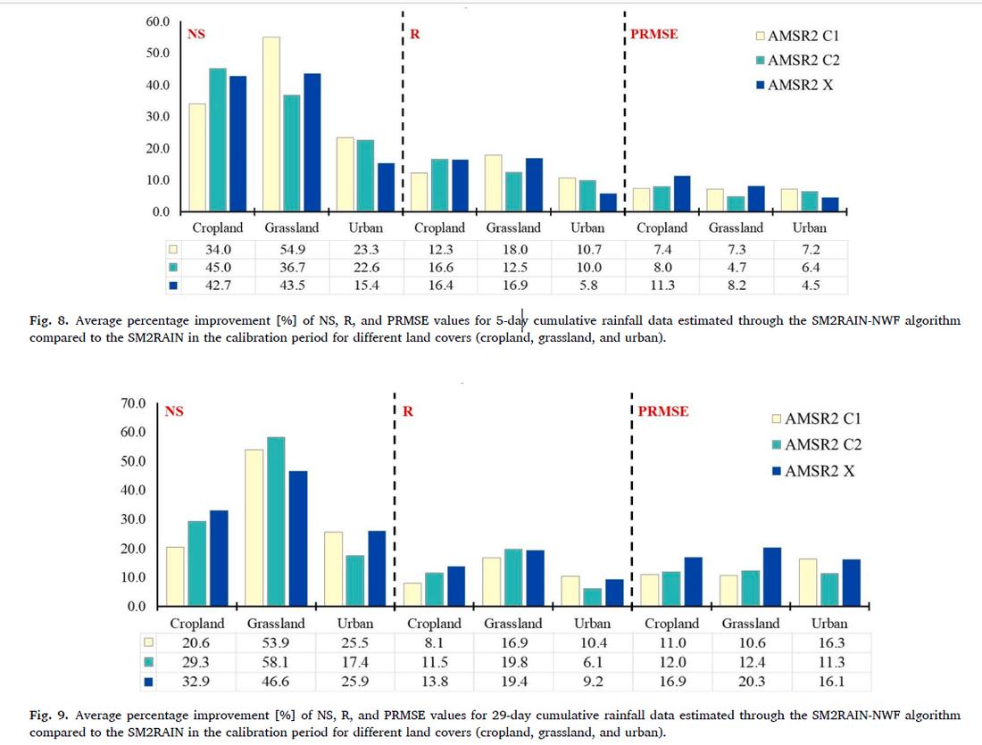
Building on the net water flux analytical model of Sadeghi et al. (2019), SM2RAIN-NWF estimates rainfall using satellite soil moisture as its only input — the algorithm the later work extends.
2019 — 2020
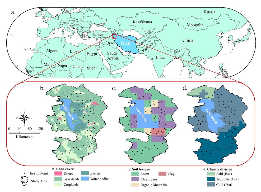
A field measurement campaign compared against AMSR2, SMAP L3, SMAP L4, and GLDAS, stratified by climate, soil texture, and land cover.
“What we observe is not nature itself, but nature exposed to our method of questioning.”
— Werner Heisenberg
Updated April 2026
Peer-reviewed journal articles and conference contributions. Filter by year or search titles, venues, and co-authors.
AGU Annual Meeting and IEEE IGARSS presentations
Most articles are available open access through the DOI links above. For anything paywalled, email me and I will send a copy.
Network
Across NASA Goddard, US Army ERDC, CNR Italy, University of Virginia, GIST, Wageningen, and Reading.
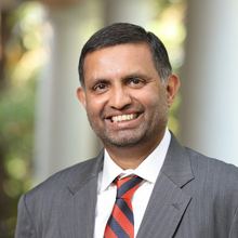
B. Howell Griswold, Jr. Professor, Whiting School of Engineering, Johns Hopkins University · President, Hydrology Section, AGU
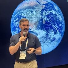
Chief, Hydrological Sciences Laboratory, NASA Goddard Space Flight Center
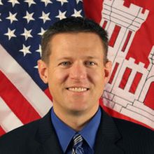
Coastal and Hydraulics Laboratory, US Army Engineer Research and Development Center, Vicksburg, MS, USA
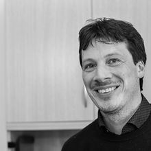
Director of Research, Research Institute for Geo-Hydrological Protection, CNR Italy

School of Environment and Energy Engineering, Gwangju Institute of Science and Technology (GIST)
Water Resources Control Engineer, California Water Resources Control Board, Sacramento, CA

Doctoral candidate, Wageningen University & Research

Postdoctoral Researcher, University of Reading, UK
Curriculum Vitae
Johns Hopkins University
University of Virginia
Ph.D., Geography & Environmental Engineering
Department of Environmental Health and Engineering · Baltimore, MD, USA
Dissertation: AI-Driven and Physics-Informed Rainfall Retrieval for Data-Scarce Regions: Supporting GPM Through NASA Multi-Mission Observations
Advisor: Venkataraman Lakshmi
Ph.D., Civil Engineering
Charlottesville, VA, USA

M.Sc., Civil Engineering — Water Resources Engineering & Management
Tehran, Iran · GPA 3.88 / 4.0
Thesis: Estimation of rainfall based on water balance equations and net water flux in soil using satellite-based soil moisture data
B.Sc., Civil Engineering
University of Virginia
Johns Hopkins University
Get in touch
Happy to hear about collaborations, data sharing, and reviewing requests.
If you have a keen interest in the intersection of climate change, satellite remote sensing, and hydrological modeling, I am glad to talk about joint work, data, and code.