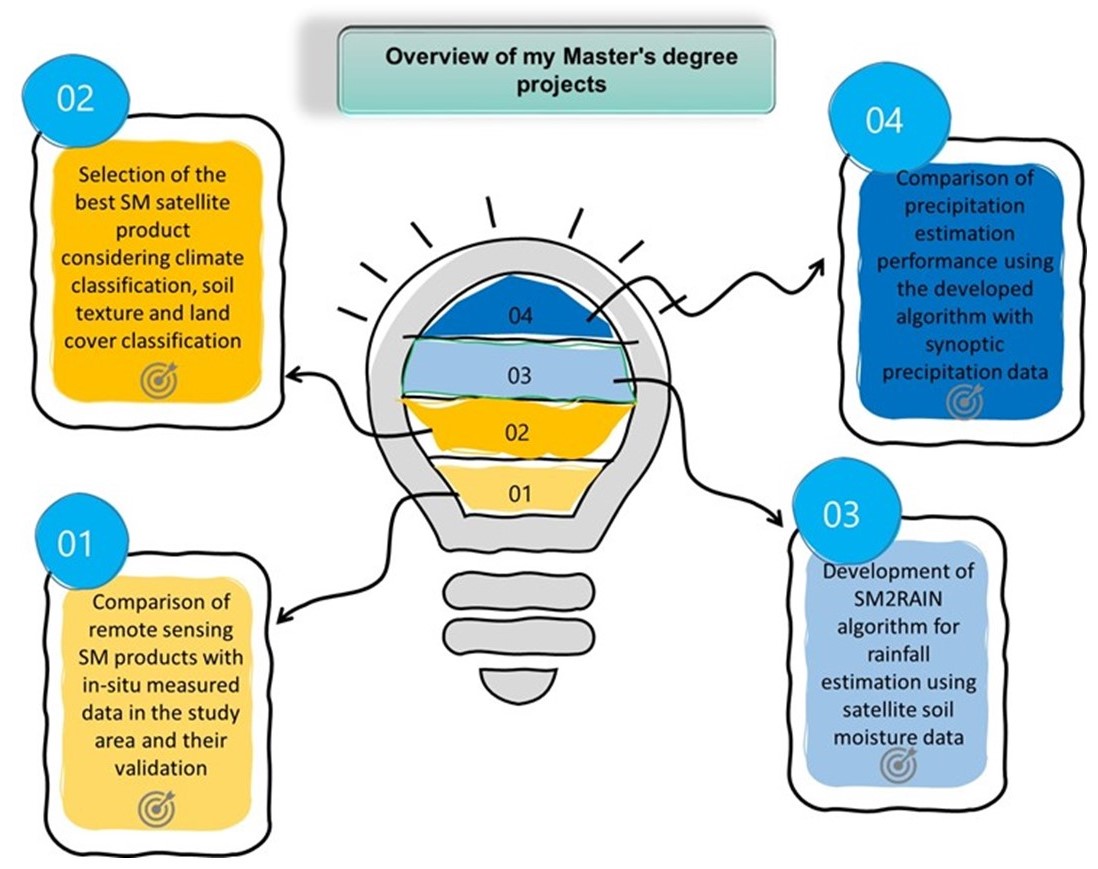
[4] Application of the SM2RAIN-NWF rainfall estimation algorithm in diverse practical research areas, including runoff estimation, quantification of irrigation, and drought monitoring. (2022-ongoing)
[3] Evaluation of the SM2RAIN-NWF algorithm’s performance across local, regional, and continental scales, with a focus on enhancing its accuracy. (2021-ongoing)
![]() Temperature as a secondary variable: Could specify a temperature threshold to reinforce the SM2RAIN-NWF to affect the quality of rainfall estimation?
Temperature as a secondary variable: Could specify a temperature threshold to reinforce the SM2RAIN-NWF to affect the quality of rainfall estimation?
![]() How does the performance of the SM2RAIN-NWF algorithm change spatially in diverse climates (on a national scale) compared to the SM2RAIN algorithm?
How does the performance of the SM2RAIN-NWF algorithm change spatially in diverse climates (on a national scale) compared to the SM2RAIN algorithm?
![]() In terms of rainfall estimation, what is the effect of combining active and passive soil moisture data?
In terms of rainfall estimation, what is the effect of combining active and passive soil moisture data?
![]() Assessment of the gap-filling method: Can discrete cosine transform method affect the quality of rainfall estimation?
Assessment of the gap-filling method: Can discrete cosine transform method affect the quality of rainfall estimation?
[2] SM2RAIN-NWF: A new algorithm by integrating SM2RAIN and the analytical net water flux models. (2020-2022)
Using the net water flux analytical model presented by Sadeghi et al. (2019), the SM2RAIN model has been developed. The purpose of this developed algorithm (i.e., SM2RAIN-NWF) is to estimate rainfall through satellite soil moisture data as the only input using the integration of the SM2RAIN algorithm and the NWF model.
![]() Is the SM2RAIN-NWF algorithm capable of providing more accurate rainfall estimates than the SM2RAIN algorithm?
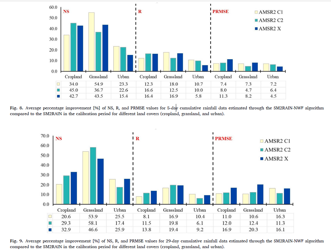
Is the SM2RAIN-NWF algorithm capable of providing more accurate rainfall estimates than the SM2RAIN algorithm?
![]() What is the difference between the performance of the two algorithms in estimating rainfall in different land covers?
What is the difference between the performance of the two algorithms in estimating rainfall in different land covers?
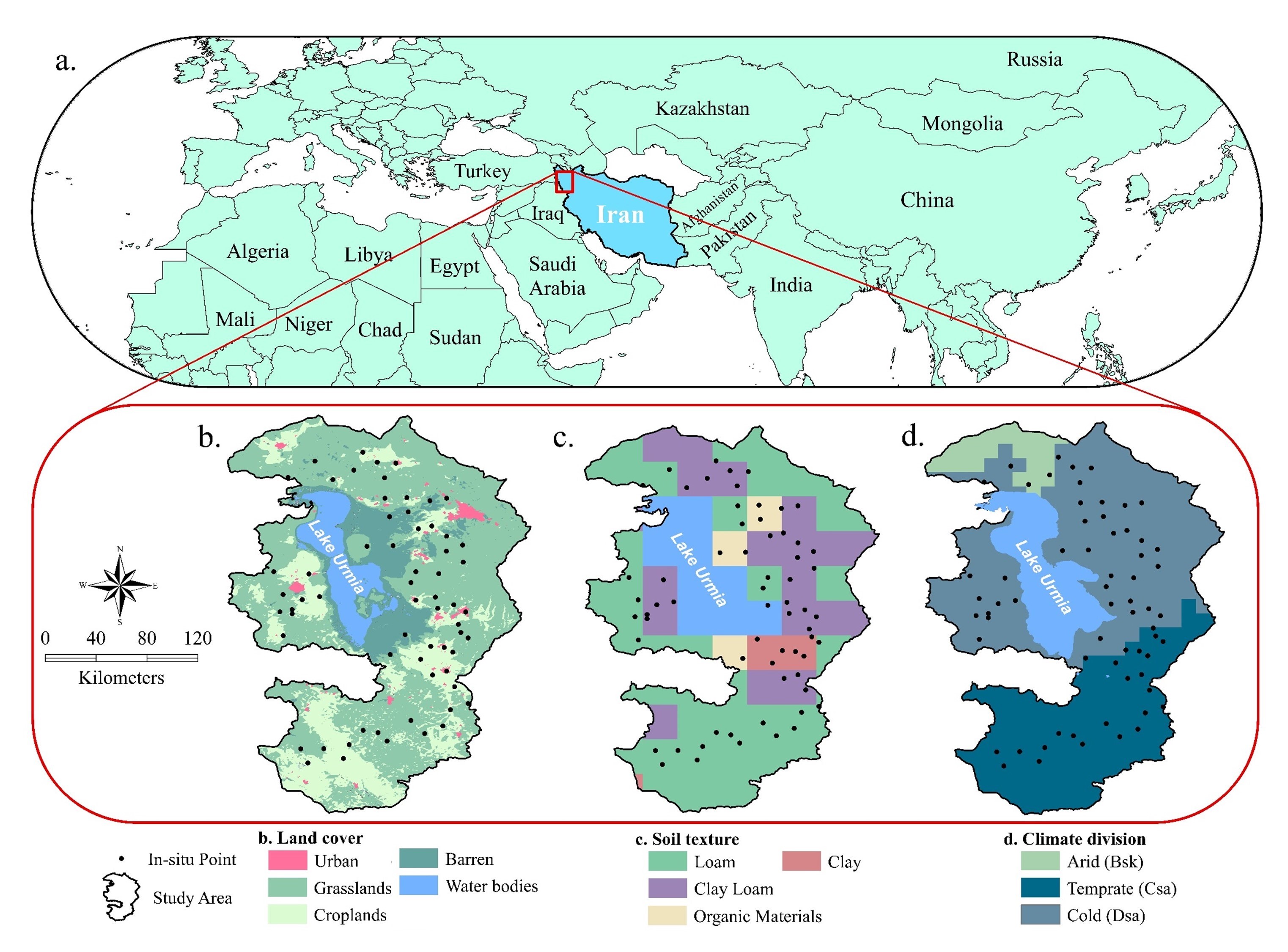
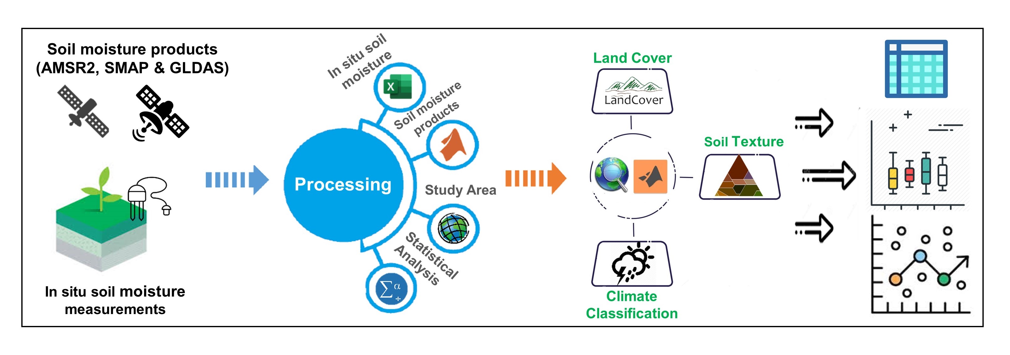
[1] In situ measurement of soil moisture and its comparison with satellite- and model-based data (AMSR2, SMAP L3, SMAP L4 and GLDAS) in the Lake Urmia basin. (2019-2020)
![]() Which soil moisture satellite products are the best choice for other studies in Lake Urmia basin?
Which soil moisture satellite products are the best choice for other studies in Lake Urmia basin?
![]() What is the level of accuracy of remotely sensed soil moisture products compared to in-situ soil moisture measurement products based on climate, soil texture, and land cover classifications?
What is the level of accuracy of remotely sensed soil moisture products compared to in-situ soil moisture measurement products based on climate, soil texture, and land cover classifications?
 A summary of my master’s degree projects